Safety tracking while Mountain Biking or Hiking
Tracking - A must for anybody interested in the outdoors, mountain biking or hiking

I offer Mountain Biking and Hiking Tours and decided to test this free tracking service.

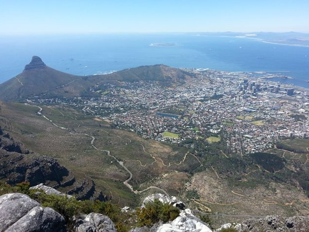
My plan was to hike a route on Table Mountain that I wanted to implement in our hiking program and needed the correct data, meaning distance and also pictures. This would then be published on the tours page. My route was to start from Kirstenbosch Botanical Garden, hike up Skeleton Gorge, then continue west via the Helly-Hutchenson Damm as I wanted to find a cave that some use to overnight in. Then head north on the hiking trail via Vaaikoppie to the highest point on the mountain, namely Mac Clears Beacon and return via Smuts Track and down the way I had come up. Things did not go as planned !!
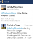
 Driving into town from where I live, I could see the cloud cover on the berg but decided to try anyway because the closer I got to Kirstenbosch, the clearer the mountain got. So, at Kirstenbosch I tweeted "@SafetyMountain" and gave my route/ number of pax and my ETA before starting my hiking tour. All this info is vital for the tracker. And off I went, I in fact did not get an immediate reply and did not want to hang around waiting, but also knew that I was being watched and in good hands.
Hiking up Skeleton Gorge after some heavy rain storms made the boulder hopping fun as the river was flowing and the entire gorge was alive with sound and water all over the place. I also met, close to the top, a group of people who were clearly inadequately dressed and or prepared for their walk, I think they had one small backpack and 1.5l water between the seven of them. Anyway after some chitchat I headed off on my way and was happy that I had the needed gear !!. Getting to the top of the gorge I then followed the track west and as soon as I got over the small sandy dune, the weather struck. It was windy and I could see the cloud coming in from the north west as it billowed over the back of the table. I still pushed on, and by the time I got to behind the dam wall, I could barely see 500m ahead of me. Ok, so what now. I took shelter behind the Museum building and warmed myself with the coffee and snacks I had brought and just enjoyed this ghostly atmosphere knowing I would probably not continue my journey as planned due to adverse conditions that were brewing.

I can honestly say that anybody who has an active outdoor life stlye, no matter if doing a Mountain Biking Tour, hiking or trail running, everybody is welcome to use this system. They (Hikers Network/ mountain safety) are well connected to Search and Rescue, SAP, Fire Department and at a push of a button, send help in any form.
How to use the system:
Contact Tim on 0834445267 OR Michael on 0825757123 (Whatsapp/SMS). One of them will load you onto a Tracking Whatsapp group.
To be tracked please register HERE this online application will capture any relevant info in case of an emergency. See the benefits of using this tracking system, but also the registration of such:
- A team of volunteers will be following your progress
- You will be in direct contact with rescue teams
- In case of an emergency, you will be contacted by the correct resources
- NO need to hunt for emergency numbers
- Greater response times by the crew
Instructions on being tracked:
This is a short list of basic instructions for all mountain users who are being tracked and for a tracker who Is tracking mountain users. In order for the tracking to work we need certain things from both parties.
If you wish to be tracked there is ONLY 4 bits of vital information that the tracker needs in order to track you. These bits of information are as follows:
1. The time that you are starting your trip eg. 8:30am
2.How many people there are in the group including the ‘trackee’ eg- tracked hiker/runner/biker
3.What is your planned route. This is very vital and if you make any changes anywhere along the route you should check-in with your tracker before you make this change otherwise we would be tracking you in the wrong area! eg- Starting Theresa Ave along pipe track to Corridor then into Tranquility cracks. 12 Apostles path, down Kasteelspoort and return to Theresa Ave.
4. Your estimated time of arrival at end of the route. This is not as important as other information and is a estimation that you will work towards and keep a eye on time as you are on your route. If you feel that you are not going to meet this finish time then inform your tracker of a new estimated time of arrival. eg- ETA 1:30pm
Please always note that if there is any change at any of your route plans it is in your own interest to inform your tracker as soon as possible.
When you check-in all you have to type on whatsapp,SMS or twitter is the following (based on the example above)
830am/7pax/theresa ave-pipe track-tranq cracks-Kasteels-home/ETA130pm.
If you reach a intersection or a adjoining path that you are mot sure of then you can check-in for advise. Remember the more detail you send your tracker the better chance the rescue team have of locating you faster!
PLEASE NOTE: Should you decide to go on a hike covering multi days, the tracker will require a check in at least once a day( only possible with cell reception) so turn phone off and only turn on for a check in to conserve battery life. The tracker will also require a alternative contact in case of a emergency. Also send a itinerary of the trail start to finish so the tracker can revert to it in case of a emergency. This is the better option when doing a multi day hike or any multi day type of tour. Our goal for tracking is to keep it plain and simple but informed!
Please click here for the full Eco Mates website - Powered by Outdoor Safety
Post article note: With outdoor activities on the increase and the work done within the communities by the different hiking groups who use Table Mountain and the Western Cape in general, the tracking system now has three rooms to track via WhatsApp. It’s such a blast for us to see the young and old now having the possibility of going up the “Berg” and no longer just having to view the mountain from their homes.
The current stats for 2016 are 3101 pax tracked for this year alone, and we are only half way through the year…..
